Another resource for Maryland maps is the U.S. Government Information, Maps & GIS Services map collection, located in the west wing of McKeldin Library on the 4th floor.
The print map collection contains approximately 350,000 maps, atlases and map-related reference materials. Most maps and charts were published in the latter half of the 20th century by U.S. government agencies and acquired through the Federal Depository Library Program. Other publishers, including foreign government agencies (e.g., Britain's Ordnance Survey) and non-governmental and commercial entities (e.g., UNESCO, National Geographic Society, Michelin) are also represented in the collection. The collection covers the United States and its territories and possessions, as well as many areas outside of the United States.
The GovMG collection of topographic maps and soil maps are also good sources of historical cartography, as are maps from the Congressional Serial Set, which includes hundreds of maps depicting the growth and development of Georgetown and Washington, D.C., as well as Maryland and the Chesapeake Bay region.

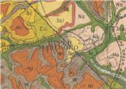
PG County soil map (1901)
For more information about the maps available through the U.S. Government Information, Maps & GIS Service, please visit the U.S. Government Information, Maps & GIS Services website.
